Use coupon code “WINTER20” for a 20% discount on all items! Valid until 30-11-2024

Site Logo
Search Suggestions

      Royal Mail  express delivery to UK destinations

      Regular sales and promotions

      Stock updates every 20 minutes!

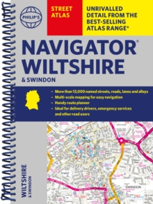
      Philip’s Navigator Street Atlas Wiltshire and Swindon

      3 in stock

      Firm sale: non returnable item
      SKU 9781849076395 Categories ,
      Select Guide Rating
      The only county Street Atlas with all the named streets of Wiltshire and Swindon and perfect back-up for emergency services, delivery drivers, visitors and locals.

      The only county Street Atlas with all the named streets of Wiltshire and Swindon and perfe...

      £16.99

      Buy new:

      Delivery: UK delivery Only. Usually dispatched in 1-2 working days.

      Shipping costs: All shipping costs calculated in the cart or during the checkout process.

      Standard service (normally 2-3 working days): 48hr Tracked service.

      Premium service (next working day): 24hr Tracked service – signature service included.

      Royal mail: 24 & 48hr Tracked: Trackable items weighing up to 20kg are tracked to door and are inclusive of text and email with ‘Leave in Safe Place’ options, but are non-signature services. Examples of service expected: Standard 48hr service – if ordered before 3pm on Thursday then expected delivery would be on Saturday. If Premium 24hr service used, then expected delivery would be Friday.

      Signature Service: This service is only available for tracked items.

      Leave in Safe Place: This option is available at no additional charge for tracked services.

      Description

      Product ID:9781849076395
      Product Form:Spiral bound
      Country of Manufacture:GB
      Series:Philip's Street Atlas
      Title:Philip's Navigator Street Atlas Wiltshire and Swindon
      Authors:Author: Philip's Maps
      Page Count:256
      Subjects:Street maps and city plans, Street maps & city plans, Wiltshire
      Description:Select Guide Rating
      The only county Street Atlas with all the named streets of Wiltshire and Swindon and perfect back-up for emergency services, delivery drivers, visitors and locals.

      The only county Street Atlas with all the named streets of Wiltshire and Swindon and perfect back-up for emergency services, delivery drivers, visitors and locals.

      With more than 13,000 named streets, roads, lanes and alleys, this is the essential map book for residents and visitors - especially if you''re in a hurry.

      Includes all the streets in CHIPPENHAM, DEVIZES, MARLBOROUGH, SALISBURY, SWINDON, TROWBRIDGE, Warminster, Amesbury, Avebury, Bradford-on-Avon, Burbage, Calne, Corsham, Cricklade, Durrington, Frome, Great Bedwyn, Highworth, Hungerford, Lambourn, Larkhill, Lechlade-on-Thames, Little Bedwyn, Ludgershall, Lyneham, Malmesbury, Melksham, Mere, Pewsey, Purton, Royal Wootton Bassett, Shaftesbury, South Cerney, Stourton, Tidworth, Westbury, Wilton.

      - New completely revised edition in practical spiral-bound format
      - Street maps show car parks, schools, hospitals and many other places of interest, including off the beaten track
      - 4-page practical route-planning section showing all A and B roads
      - Super-clear mapping
      - Easy-to-use index
      - Scales: 1¾ inches to 1 mile (1:36,000) and 3½ inches to 1 mile (1:18,000).

      Other information on the maps includes postcode boundaries, car parks, railway and bus stations, post offices, schools, colleges, hospitals, police and fire stations, places of worship, leisure centres, footpaths and bridleways, camping and caravan sites, golf courses, and many other places of interest.


      Imprint Name:Philip's
      Publisher Name:Octopus Publishing Group
      Country of Publication:GB
      Publishing Date:2024-01-18

      Additional information

      Weight556 g
      Dimensions196 × 270 × 18 mm