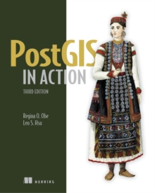
Description
| Product ID: | 9781617296697 |
| Product Form: | Paperback / softback |
| Country of Manufacture: | US |
| Title: | PostGIS in Action, Third Edition |
| Authors: | Author: Leo Hsu, Regina Obe |
| Page Count: | 600 |
| Subjects: | Database software, PostgreSQL |
| Description: | Select Guide Rating PostGIS in Action, Third Edition teaches you to solve real-world geodata problems. It first gives you a background in vector-, raster-, and topology-based GIS and then quickly moves into analyzing, viewing, and mapping data. You''ll learn how to optimize queries for maximum speed, simplify geometries for greater efficiency, and create custom functions for your own applications. You''ll also learn how to apply your existing GIS knowledge to PostGIS and integrate with other GIS tools.
Fully updated to the latest versions of PostGIS and PostgreSQL, this Third Edition covers new PostGIS features including Foreign Data Wrappers, Database as a Service, parallelization of queries, and new JSON and Vector Tiles functions that help in creating web mapping applications.
Key Features · An introduction to spatial databases · Geometry, geography, raster, and topology spatial types, · functions, and queries · Applying PostGIS to real-world problems · Extending PostGIS to web and desktop applications · Updated for PostGIS 3 and PostgreSQL 12
For readers familiar with relational databases and basic SQL.
About the technology Processing location and topology data requires specialized know-how. PostGIS is a free spatial database extender for PostgreSQL that delivers the features and firepower you need to take on nearly any geodata task. With it, you can easily create location-aware queries in just a few lines of SQL code and build the back end for a mapping, raster analysis, or routing application with minimal effort. PostGIS in Action, Third Edition teaches you to solve real-world geodata problems. It first gives you a background in vector-, raster-, and topology-based GIS and then quickly moves into analyzing, viewing, and mapping data. You''ll learn how to optimize queries for maximum speed, simplify geometries for greater efficiency, and create custom functions for your own applications. You''ll also learn how to apply your existing GIS knowledge to PostGIS and integrate with other GIS tools.
Fully updated to the latest versions of PostGIS and PostgreSQL, this Third Edition covers new PostGIS features including Foreign Data Wrappers, Database as a Service, parallelization of queries, and new JSON and Vector Tiles functions that help in creating web mapping applications.
Key Features · An introduction to spatial databases · Geometry, geography, raster, and topology spatial types, · functions, and queries · Applying PostGIS to real-world problems · Extending PostGIS to web and desktop applications · Updated for PostGIS 3 and PostgreSQL 12
For readers familiar with relational databases and basic SQL.
About the technology Processing location and topology data requires specialized know-how. PostGIS is a free spatial database extender for PostgreSQL that delivers the features and firepower you need to take on nearly any geodata task. With it, you can easily create location-aware queries in just a few lines of SQL code and build the back end for a mapping, raster analysis, or routing application with minimal effort.
Regina Obe and Leo Hsu are database consultants and authors. Regina is a member of the PostGIS core development team and the Project Steering Committee. |
| Imprint Name: | Manning Publications |
| Publisher Name: | Manning Publications |
| Country of Publication: | GB |
| Publishing Date: | 2021-11-03 |


