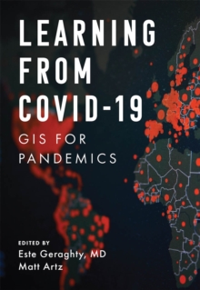
Description
| Product ID: | 9781589487116 |
| Product Form: | Paperback / softback |
| Country of Manufacture: | GB |
| Series: | Applying GIS |
| Title: | Learning from COVID-19 |
| Subtitle: | GIS for Pandemics |
| Authors: | Author: Este Geraghty, Matt Artz |
| Page Count: | 175 |
| Subjects: | Epidemiology and Medical statistics, Epidemiology & medical statistics, Infectious and contagious diseases, Geographical information systems, geodata and remote sensing, Infectious & contagious diseases, Geographical information systems (GIS) & remote sensing |
| Description: | Select Guide Rating Learning from COVID-19: GIS for Pandemics explores a collection of real-life case studies about how organizations across the globe have successfully used GIS to respond to the COVID-19 pandemic. Now that the health community is in a state of reflection, how do we put the lessons learned into practice? As we step back to examine the worldwide response to the COVID-19 pandemic, now is the time to think about how to raise the bar for our response to the next public health emergency. Now is the time to revisit health preparedness strategies and plans. And now is the time to review what the health community did that worked—and how we can do that again. Learning from COVID-19: GIS for Pandemics tells real-life stories about how spatial thinking became invaluable in both local and full-scale outbreaks during the COVID-19 pandemic. Needing to answer the question of “where” sat at the forefront of everyone’s mind, and using a geographic information system (GIS) for real-time surveillance transformed possibly overwhelming data into location intelligence that provided agencies and civic leaders with valuable insights. Co-edited by Esri chief medical officer Dr. Este Geraghty, this book highlights best practices, key GIS capabilities, and lessons learned during the COVID-19 response that can help communities prepare for the next crisis. GIS has empowered:
Learning from COVID-19 also includes a “next steps” section that provides ideas, strategies, tools, and actions to help jump-start your own use of GIS, either as a citizen scientist or a health professional. A collection of online resources, including additional stories, videos, new ideas and concepts, and downloadable tools and content, complements this book. Now is the time to use science and data to make informed decisions for our future, and this book shows us how we can do it. |
| Imprint Name: | Environmental Systems Research Institute Inc.,U.S. |
| Publisher Name: | ESRI Press |
| Country of Publication: | GB |
| Publishing Date: | 2022-09-29 |


