Use coupon code “WINTER20” for a 20% discount on all items! Valid until 30-11-2024

Site Logo
Search Suggestions

      Royal Mail  express delivery to UK destinations

      Regular sales and promotions

      Stock updates every 20 minutes!

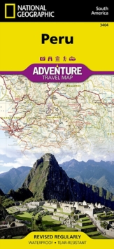
      Peru: Travel Maps International Adventure Map

      3 in stock

      Firm sale: non returnable item
      SKU 9781566955485 Categories ,
      AdventureMaps provide global travellers with the perfect combination of detail and perspective. The front side of this map shows the northern half of Peru, spanning from Peru's borders with Ecuador and Colombia on the north and Brazil on the east, down to the coastal city of Chimbote, covering the r...

      £14.95

      Buy new:

      Delivery: UK delivery Only. Usually dispatched in 1-2 working days.

      Shipping costs: All shipping costs calculated in the cart or during the checkout process.

      Standard service (normally 2-3 working days): 48hr Tracked service.

      Premium service (next working day): 24hr Tracked service – signature service included.

      Royal mail: 24 & 48hr Tracked: Trackable items weighing up to 20kg are tracked to door and are inclusive of text and email with ‘Leave in Safe Place’ options, but are non-signature services. Examples of service expected: Standard 48hr service – if ordered before 3pm on Thursday then expected delivery would be on Saturday. If Premium 24hr service used, then expected delivery would be Friday.

      Signature Service: This service is only available for tracked items.

      Leave in Safe Place: This option is available at no additional charge for tracked services.
      Description

      Product ID:9781566955485
      Product Form:Sheet map, folded
      Country of Manufacture:US
      Title:Peru
      Subtitle:Travel Maps International Adventure Map
      Authors:Author: National Geographic Maps
      Page Count:1
      Subjects:Travel maps and atlases, Travel maps & atlases, Peru
      Description:AdventureMaps provide global travellers with the perfect combination of detail and perspective. The front side of this map shows the northern half of Peru, spanning from Peru's borders with Ecuador and Colombia on the north and Brazil on the east, down to the coastal city of Chimbote, covering the regions such as Loreto, Amazonas, La Libertad, and Ucayali. Many other regions, such as Tacna, Madre de Dios, Lima and Apurmac are included on the reverse. Provincial and political borders are clearly and accurate marked with coloured boundaries, as are the borders of national parks.
      Imprint Name:National Geographic Maps
      Publisher Name:National Geographic Maps
      Country of Publication:GB
      Publishing Date:2011-07-14

      Additional information

      Weight92 g
      Dimensions110 × 234 × 7 mm