Use coupon code “WINTER20” for a 20% discount on all items! Valid until 30-11-2024

Site Logo
Search Suggestions

      Royal Mail  express delivery to UK destinations

      Regular sales and promotions

      Stock updates every 20 minutes!

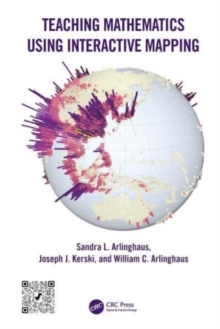
      Teaching Mathematics Using Interactive Mapping

      2 in stock

      Firm sale: non returnable item
      SKU 9781032305332 Categories ,
      Select Guide Rating
      Teaching Mathematics Using Interactive Mapping provides mathematics instructors and students with an engaging set of activities that foster spatial and critical thinking and provide core mathematics principles and foundations behind each activity. The activities focus on web-b...

      £45.99

      Buy new:

      Delivery: UK delivery Only. Usually dispatched in 1-2 working days.

      Shipping costs: All shipping costs calculated in the cart or during the checkout process.

      Standard service (normally 2-3 working days): 48hr Tracked service.

      Premium service (next working day): 24hr Tracked service – signature service included.

      Royal mail: 24 & 48hr Tracked: Trackable items weighing up to 20kg are tracked to door and are inclusive of text and email with ‘Leave in Safe Place’ options, but are non-signature services. Examples of service expected: Standard 48hr service – if ordered before 3pm on Thursday then expected delivery would be on Saturday. If Premium 24hr service used, then expected delivery would be Friday.

      Signature Service: This service is only available for tracked items.

      Leave in Safe Place: This option is available at no additional charge for tracked services.

      Description

      Product ID:9781032305332
      Product Form:Paperback / softback
      Country of Manufacture:GB
      Title:Teaching Mathematics Using Interactive Mapping
      Authors:Author: Joseph J. Kerski, William C. Arlinghaus, Sandra L. Arlinghaus
      Page Count:225
      Subjects:Teacher training, Teacher training, Teaching of a specific subject, Mathematics, Applied mathematics, Human geography, Geographical information systems, geodata and remote sensing, Educational material, Teaching of a specific subject, Mathematics, Applied mathematics, Human geography, Geographical information systems (GIS) & remote sensing, Educational material
      Description:Select Guide Rating
      Teaching Mathematics Using Interactive Mapping provides mathematics instructors and students with an engaging set of activities that foster spatial and critical thinking and provide core mathematics principles and foundations behind each activity. The activities focus on web-based GIS and are interactive and engaging.

      Teaching Mathematics Using Interactive Mapping offers novel ways to learn basic math topics such as simple relational measures or measuring hierarchies through customized interactive mapping activities. These activities focus on interactive web-based Geographic Information System (GIS) and are relevant to today’s problems and challenges. Written in a guided, hands-on, understandable manner, all activities are designed to build practical and problem-solving skills that rest on mathematical principles and move students from thinking about maps as references that focus solely on "where is" something, to analytical tools, focusing primarily on the "whys of where." Success with this transition through interaction permits most readers to master mathematical concepts and GIS tools.

      FEATURES

      • Offers custom-designed geographical activities to fit with specific mathematical topics
      • Helps students become comfortable using mathematics in a variety of professions
      • Provides an innovative, engaging, and practical set of activities to ease readers through typically difficult, often elementary, mathematical topics: fractions, the distributive law, and much more
      • Uses web-based GIS maps, apps, and other tools and data that can be accessed on any device, anywhere, at any time, requiring no prior GIS background
      • Written by experienced teachers and researchers with lifelong experience in teaching mathematics, geography, and spatial analysis
      • Features an accompanying Solution Guide, available on the book''s product page, that is beneficial for instructors, students, and other readers as an aid to gauging progress.

      This textbook applies to undergraduate and graduate students in universities and community colleges including those in basic mathematics courses, as well as upper-level undergraduate and graduate students taking courses in geographic information systems, remote sensing, photogrammetry, geography, geodesy, information science, engineering, and geology. Professionals interested in learning techniques and technologies for collecting, analyzing, managing, processing, and visualizing geospatial datasets will also benefit from this book as they refresh their knowledge in mathematics.


      Imprint Name:CRC Press
      Publisher Name:Taylor & Francis Ltd
      Country of Publication:GB
      Publishing Date:2023-12-11

      Additional information

      Weight542 g
      Dimensions178 × 254 × 16 mm