Use coupon code “SUMMER20” for a 20% discount on all items! Valid until 2024-08-31

Site Logo
Search Suggestions

      Royal Mail  express delivery to UK destinations

      Regular sales and promotions

      Stock updates every 20 minutes!

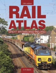
      Rail Atlas Of Great Britain And Ireland 15th Edition: 15th Edition

      Out of stock

      Firm sale: non returnable item
      SKU 9780860936817 Categories ,
      Select Guide Rating
      The Atlas is the most accurate, reliable and up to date guide to the current railway network in the British Isles. Lines open to all traffic and those used by freight only are differentiated as are single track sections.
      The Rail Atlas of Great Britain and Ireland was first...

      £20.00

      Buy new:

      Delivery: UK delivery Only. Usually dispatched in 1-2 working days.

      Shipping costs: All shipping costs calculated in the cart or during the checkout process.

      Standard service (normally 2-3 working days): 48hr Tracked service.

      Premium service (next working day): 24hr Tracked service – signature service included.

      Royal mail: 24 & 48hr Tracked: Trackable items weighing up to 20kg are tracked to door and are inclusive of text and email with ‘Leave in Safe Place’ options, but are non-signature services. Examples of service expected: Standard 48hr service – if ordered before 3pm on Thursday then expected delivery would be on Saturday. If Premium 24hr service used, then expected delivery would be Friday.

      Signature Service: This service is only available for tracked items.

      Leave in Safe Place: This option is available at no additional charge for tracked services.
      Description

      Product ID:9780860936817
      Product Form:Hardback
      Country of Manufacture:GB
      Title:Rail Atlas Of Great Britain And Ireland 15th Edition
      Subtitle:15th Edition
      Authors:Author: S. K Baker
      Page Count:136
      Subjects:Trains and railways: general interest, Trains & railways: general interest, United Kingdom, Great Britain
      Description:Select Guide Rating
      The Atlas is the most accurate, reliable and up to date guide to the current railway network in the British Isles. Lines open to all traffic and those used by freight only are differentiated as are single track sections.
      The Rail Atlas of Great Britain and Ireland was first published in 1977 and 2018 will see the release of its new 15th edition, proof indeed that the Atlas is one of the most successful and sought after railway titles ever published. The Atlas is the most accurate, reliable and up to date guide to the current railway network in the British Isles. Lines open to all traffic and those used by freight only are differentiated as are single track sections. The maps also show preserved lines, freight terminals, LRT schemes, passenger stations, lines under construction and proposed lines. This new edition as always has been fully revised and updated whilst retaining the convenient format established in previous editions. The mapping on each page overlaps with that on adjoining pages to make it easier to follow a long-distance route. Where appropriate, additional detailed inset maps have been drawn to show the complex railway developments in metropolitan areas such as London and Manchester. The Rail Atlas of Great Britain and Ireland continues to be the essential work of reference for both railway enthusiasts and those working in the railway industry.
      Imprint Name:Crecy Publishing
      Publisher Name:Crecy Publishing
      Country of Publication:GB
      Publishing Date:2020-06-12

      Additional information

      Weight610 g
      Dimensions250 × 179 × 17 mm