Use coupon code “WINTER20” for a 20% discount on all items! Valid until 30-11-2024

Site Logo
Search Suggestions

      Royal Mail  express delivery to UK destinations

      Regular sales and promotions

      Stock updates every 20 minutes!

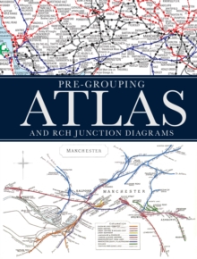
      Pre-Grouping Atlas and RCH Junction Diagrams

      4 in stock

      Firm sale: non returnable item
      SKU 9780711038103 Categories ,
      Select Guide Rating
      Following the popularity of other historical railway atlases, this is an enlarged edition of the Pre-Grouping Atlas combined with the Railway Clearing House Junction Diagrams. The pages will show a map of the British railway network for a particular region immediately prior to...

      £30.00

      Buy new:

      Delivery: UK delivery Only. Usually dispatched in 1-2 working days.

      Shipping costs: All shipping costs calculated in the cart or during the checkout process.

      Standard service (normally 2-3 working days): 48hr Tracked service.

      Premium service (next working day): 24hr Tracked service – signature service included.

      Royal mail: 24 & 48hr Tracked: Trackable items weighing up to 20kg are tracked to door and are inclusive of text and email with ‘Leave in Safe Place’ options, but are non-signature services. Examples of service expected: Standard 48hr service – if ordered before 3pm on Thursday then expected delivery would be on Saturday. If Premium 24hr service used, then expected delivery would be Friday.

      Signature Service: This service is only available for tracked items.

      Leave in Safe Place: This option is available at no additional charge for tracked services.

      Description

      Product ID:9780711038103
      Product Form:Hardback
      Country of Manufacture:GB
      Title:Pre-Grouping Atlas and RCH Junction Diagrams
      Authors:Author: Ian Allan Publishing Ltd
      Page Count:192
      Subjects:Trains and railways: general interest, Trains & railways: general interest, United Kingdom, Great Britain, c 1918 to c 1939 (Inter-war period)
      Description:Select Guide Rating
      Following the popularity of other historical railway atlases, this is an enlarged edition of the Pre-Grouping Atlas combined with the Railway Clearing House Junction Diagrams. The pages will show a map of the British railway network for a particular region immediately prior to the 1923 Grouping, showing the owners of line and each map will be accompanied detailed drawings published by the Railway Clearing House in 1914 of the junctions within that region. Immediately prior to the Grouping there were roughly 150 independent railway companies operating in the UK and each company''s lines are colour coded in the atlas, allowing the reader to easily trace the historical operations of that company, even through the complex junctions. The atlas and junction diagrams are supplemented by a detailed list of all stations, junctions and companies in operation at that time, as well as additional information on features such as tunnels, watertroughs, viaducts and summits.This book will be an invaluable work of reference to the complex railway system in Britain 100 years ago and will appeal to railway enthusiasts and historians alike.
      Imprint Name:Ian Allan Publishing
      Publisher Name:Crecy Publishing
      Country of Publication:GB
      Publishing Date:2014-11-13

      Additional information

      Weight1016 g
      Dimensions288 × 211 × 18 mm