| Description: | Select Guide Rating
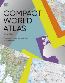
Colourful maps, flags and fascinating insights make this pocket sized atlas an ideal source of information about our ever changing world. Arranged in two main sections - a world atlas and country factfile - the Pocket A-Z World Atlas provides an invaluable source of accurate, informative and interesting geographical information, all in one compact and affordable volume. The atlas section, arranged by continent, presents over 70 colourful, clearly labelled, easy-to-read regional maps showing all the world's nations, combining digital landscape modelling with the most important roads, railways, rivers, and settlements. Each map is annotated with fascinating 'insight' facts that reveal a wealth of amazing information from around the world. The second section comprises a comprehensive series of country profiles, arranged alphabetically, covering all the essential facts and figures, including details of geography, climate, society, and economics. This section also contains reference factfile data for every nation, including the national flag, total area, population, languages, religions, and currency. Dive straight in to discover: - This new fully revised 8th Edition incorporating hundreds of updates to maps and statistics. - 71 regional maps, 196 country profile maps, flags, and statistics. - In-depth country profiles. - Fully cross-referenced index/gazetteer. Finding places is quick and convenient with a clearly-styled index of 7,000 atlas section place-names. Ideal for family reference, crosswords, and quizzes, this atlas presents an intriguing and absorbing journey around the world in which we live.
Colourful maps, flags and fascinating insights make this pocket sized atlas an ideal source of information about our ever changing world.
Arranged in two main sections - a world atlas and country factfile - the Pocket A-Z World Atlas provides an invaluable source of accurate, informative and interesting geographical information, all in one compact and affordable volume. The atlas section, arranged by continent, presents over 70 colourful, clearly labelled, easy-to-read regional maps showing all the world''s nations, combining digital landscape modelling with the most important roads, railways, rivers, and settlements. Each map is annotated with fascinating ''insight'' facts that reveal a wealth of amazing information from around the world.
The second section comprises a comprehensive series of country profiles, arranged alphabetically, covering all the essential facts and figures, including details of geography, climate, society, and economics. This section also contains reference factfile data for every nation, including the national flag, total area, population, languages, religions, and currency.
Dive straight in to discover:
- This new fully revised 8th Edition incorporating hundreds of updates to maps and statistics.
- 71 regional maps, 196 country profile maps, flags, and statistics.
- In-depth country profiles.
- Fully cross-referenced index/gazetteer.
Finding places is quick and convenient with a clearly-styled index of 7,000 atlas section place-names.
Ideal for family reference, crosswords, and quizzes, this atlas presents an intriguing and absorbing journey around the world in which we live.
|


