Use coupon code “WINTER20” for a 20% discount on all items! Valid until 30-11-2024

Site Logo
Search Suggestions

      Royal Mail  express delivery to UK destinations

      Regular sales and promotions

      Stock updates every 20 minutes!

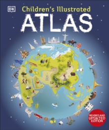
      Children’s Illustrated Atlas: Revised and Updated Edition

      Out of stock

      Firm sale: non returnable item
      SKU 9780241598283 Categories ,
      Select Guide Rating
      Set off on a thrilling journey around the world in this incredible atlas for kids - packed full of beautiful illustrations and photographs. Discover the world map-by-map with this exciting world atlas book for children, featuring more than 50 maps! Each page is filled with f...

      £14.99

      Buy new:

      Delivery: UK delivery Only. Usually dispatched in 1-2 working days.

      Shipping costs: All shipping costs calculated in the cart or during the checkout process.

      Standard service (normally 2-3 working days): 48hr Tracked service.

      Premium service (next working day): 24hr Tracked service – signature service included.

      Royal mail: 24 & 48hr Tracked: Trackable items weighing up to 20kg are tracked to door and are inclusive of text and email with ‘Leave in Safe Place’ options, but are non-signature services. Examples of service expected: Standard 48hr service – if ordered before 3pm on Thursday then expected delivery would be on Saturday. If Premium 24hr service used, then expected delivery would be Friday.

      Signature Service: This service is only available for tracked items.

      Leave in Safe Place: This option is available at no additional charge for tracked services.

      Description

      Product ID:9780241598283
      Product Form:Hardback
      Country of Manufacture:AE
      Series:Children's Illustrated Atlases
      Title:Children's Illustrated Atlas
      Subtitle:Revised and Updated Edition
      Authors:Author: DK
      Page Count:128
      Subjects:Children’s / Teenage reference: Atlases and maps, Atlases & maps (Children’s/Teenage)
      Description:Select Guide Rating
      Set off on a thrilling journey around the world in this incredible atlas for kids - packed full of beautiful illustrations and photographs. Discover the world map-by-map with this exciting world atlas book for children, featuring more than 50 maps! Each page is filled with fascinating information, facts and colourful illustrations of our world. Children aged 7-9 will love to learn all about the many countries, cultures, people and animals of the world through vibrant maps. Each map is bursting with information, combining colourful icons with photographs representing key points about each country. The atlas also includes a world map poster, with a political map for each continent - and children are shown how to read a map and use a key, compass, and scale!Inside the pages of this atlas book for children, you'll find:- Information that supports the curriculum, with colourful icons and photographs that show people and places, animals, food, historical sites, industry, and habitats. - More than 50 specially commissioned maps of the world featuring countries and continents in full-colour detail. - Bite-sized facts and figures about each country making it easy for children to understand. - Diagrams that compare climates, population, mountains and rivers, famous sites, and natural wonders of the world. Children's Illustrated Atlas brings the world to life with vivid maps and fascinating facts about the countries of the world, making it the perfect gift for little geographers. This charming and informative book is a key addition to every child's library.

      Set off on a thrilling journey around the world in this incredible atlas for kids - packed full of beautiful illustrations and photographs.

      Discover the world map-by-map with this exciting world atlas book for children, featuring more than 50 maps! Each page is filled with fascinating information, facts and colourful illustrations of our world.

      Children aged 7-9 will love to learn all about the many countries, cultures, people and animals of the world through vibrant maps. Each map is bursting with information, combining colourful icons with photographs representing key points about each country. The atlas also includes a world map poster, with a political map for each continent - and children are shown how to read a map and use a key, compass, and scale!

      Inside the pages of this atlas book for children, you''ll find:

      - Information that supports the curriculum, with colourful icons and photographs that show people and places, animals, food, historical sites, industry, and habitats.
      - More than 50 specially commissioned maps of the world featuring countries and continents in full-colour detail.
      - Bite-sized facts and figures about each country making it easy for children to understand.
      - Diagrams that compare climates, population, mountains and rivers, famous sites, and natural wonders of the world.

      Children''s Illustrated Atlas brings the world to life with vivid maps and fascinating facts about the countries of the world, making it the perfect gift for little geographers. This charming and informative book is a key addition to every child''s library.


      Imprint Name:DK Children
      Publisher Name:Dorling Kindersley Ltd
      Country of Publication:GB
      Publishing Date:2023-03-02

      Additional information

      Weight936 g
      Dimensions308 × 258 × 15 mm