Use coupon code “WINTER20” for a 20% discount on all items! Valid until 30-11-2024

Site Logo
Search Suggestions

      Royal Mail  express delivery to UK destinations

      Regular sales and promotions

      Stock updates every 20 minutes!

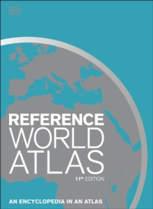
      Reference World Atlas: An Encyclopedia in an Atlas

      Out of stock

      Firm sale: non returnable item
      SKU 9780241412879 Categories ,
      Select Guide Rating
      Packed with more than 640 high-definition maps and over 950 illustrations and diagrams, this is the ultimate world atlas. Fully revised and updated edition to encompass recent world events, this extensive atlas is an invaluable reference for home, school, and office. This ...

      £30.00

      Buy new:

      Delivery: UK delivery Only. Usually dispatched in 1-2 working days.

      Shipping costs: All shipping costs calculated in the cart or during the checkout process.

      Standard service (normally 2-3 working days): 48hr Tracked service.

      Premium service (next working day): 24hr Tracked service – signature service included.

      Royal mail: 24 & 48hr Tracked: Trackable items weighing up to 20kg are tracked to door and are inclusive of text and email with ‘Leave in Safe Place’ options, but are non-signature services. Examples of service expected: Standard 48hr service – if ordered before 3pm on Thursday then expected delivery would be on Saturday. If Premium 24hr service used, then expected delivery would be Friday.

      Signature Service: This service is only available for tracked items.

      Leave in Safe Place: This option is available at no additional charge for tracked services.
      Description

      Product ID:9780241412879
      Product Form:Hardback
      Country of Manufacture:LV
      Series:DK Reference Atlases
      Title:Reference World Atlas
      Subtitle:An Encyclopedia in an Atlas
      Authors:Author: DK
      Page Count:408
      Subjects:World / regional atlases or maps, World atlases / world maps
      Description:Select Guide Rating
      Packed with more than 640 high-definition maps and over 950 illustrations and diagrams, this is the ultimate world atlas. Fully revised and updated edition to encompass recent world events, this extensive atlas is an invaluable reference for home, school, and office. This atlas of the world includes:- More than 640 high-definition, updated regional and world-wide maps based on the latest digital mapping and satellite data - Over 950 high-quality illustrations and diagrams- 3D terrain models that reveal physical features- Wide range of popular topics in the world from the solar system and the world's oceans, to global climate and landscape, and states and boundaries- Key geographical facts including population density, detailed infrastructure and transportation information, and time zones - A comprehensive index that contains more than 80,000 place names- Special 24-page feature section with detailed mapping of the British Isles (UK Edition)This indispensable atlas book opens with a wonderful introduction to our world with a series of maps that illustrate its physical, political, economic, and demographic geography. As you continue to turn the pages, you'll soon discover that this atlas is unlike any other. This engaging home learning resource delivers superb cartography through beautifully designed and incredibly informative maps, diagrams and photographs to provide accurate coverage of the whole world. It also contains a wealth of fascinating facts that help give a real flavour of the geography and culture of a region. This beautiful large-format world atlas is the perfect addition to any school or family library, or even an ideal gift for geography students!Updated 11th Edition (2021):- Hundreds of toponymic updates to the maps - Revised country and place names, for example, Eswatini (formerly Swaziland) and Czechia (formerly Czech Republic) - Updated country statistics and population numbers- Major new infrastructure projects such as new rail and road updates, including the Crimean Bridge across the Kerch Strait

      Packed with more than 640 high-definition maps and over 950 illustrations and diagrams, this is the ultimate world atlas.

      Fully revised and updated edition to encompass recent world events, this extensive atlas is an invaluable reference for home, school, and office.

      This atlas of the world includes:

      - More than 640 high-definition, updated regional and world-wide maps based on the latest digital mapping and satellite data
      - Over 950 high-quality illustrations and diagrams
      - 3D terrain models that reveal physical features
      - Wide range of popular topics in the world from the solar system and the world''s oceans, to global climate and landscape, and states and boundaries
      - Key geographical facts including population density, detailed infrastructure and transportation information, and time zones
      - A comprehensive index that contains more than 80,000 place names
      - Special 24-page feature section with detailed mapping of the British Isles (UK Edition)

      This indispensable atlas book opens with a wonderful introduction to our world with a series of maps that illustrate its physical, political, economic, and demographic geography. As you continue to turn the pages, you''ll soon discover that this atlas is unlike any other.

      This engaging home learning resource delivers superb cartography through beautifully designed and incredibly informative maps, diagrams and photographs to provide accurate coverage of the whole world. It also contains a wealth of fascinating facts that help give a real flavour of the geography and culture of a region. This beautiful large-format world atlas is the perfect addition to any school or family library, or even an ideal gift for geography students!

      Updated 11th Edition (2021):

      - Hundreds of toponymic updates to the maps
      - Revised country and place names, for example, Eswatini (formerly Swaziland) and Czechia (formerly Czech Republic)
      - Updated country statistics and population numbers
      - Major new infrastructure projects such as new rail and road updates, including the Crimean Bridge across the Kerch Strait


      Imprint Name:DK
      Publisher Name:Dorling Kindersley Ltd
      Country of Publication:GB
      Publishing Date:2021-04-01

      Additional information

      Weight2812 g
      Dimensions272 × 371 × 36 mm