Use coupon code “SUMMER20” for a 20% discount on all items! Valid until 2024-08-31

Site Logo
Search Suggestions

      Royal Mail  express delivery to UK destinations

      Regular sales and promotions

      Stock updates every 20 minutes!

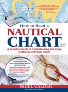
      How to Read a Nautical Chart, 2nd Edition (Includes ALL of Chart #1)

      1 in stock

      Firm sale: non returnable item
      SKU 9780071779821 Categories ,
      Select Guide Rating
      Provides information on reading and relying on electronic and paper nautical charts. This title explains various aspects of electronic and paper nautical charts: how a chart is assembled, how to gauge the accuracy of chart data, how to read charts created by other governments,...

      £17.99

      Buy new:

      Delivery: UK delivery Only. Usually dispatched in 1-2 working days.

      Shipping costs: All shipping costs calculated in the cart or during the checkout process.

      Standard service (normally 2-3 working days): 48hr Tracked service.

      Premium service (next working day): 24hr Tracked service – signature service included.

      Royal mail: 24 & 48hr Tracked: Trackable items weighing up to 20kg are tracked to door and are inclusive of text and email with ‘Leave in Safe Place’ options, but are non-signature services. Examples of service expected: Standard 48hr service – if ordered before 3pm on Thursday then expected delivery would be on Saturday. If Premium 24hr service used, then expected delivery would be Friday.

      Signature Service: This service is only available for tracked items.

      Leave in Safe Place: This option is available at no additional charge for tracked services.
      Description

      Product ID:9780071779821
      Product Form:Paperback / softback
      Country of Manufacture:US
      Title:How to Read a Nautical Chart, 2nd Edition (Includes ALL of Chart #1)
      Authors:Author: Nigel Calder
      Page Count:272
      Subjects:Navigation and seamanship, Navigation & seamanship, Boating: Sport and leisure, Boating
      Description:Select Guide Rating
      Provides information on reading and relying on electronic and paper nautical charts. This title explains various aspects of electronic and paper nautical charts: how a chart is assembled, how to gauge the accuracy of chart data, how to read charts created by other governments, how to use information such as scale, and more.

      Authoritative, practical, and hands-on information on reading and relying on electronic and paper nautical charts

      The classic How to Read a Nautical Chart explains every aspect of electronic and paper nautical charts: how a chart is assembled, how to gauge the accuracy of chart data, how to read charts created by other governments, how to use information such as scale, projection technique and datum that every chart contains; how not to get fooled or run aground by overzooming. Nigel Calder teaches you how to squeeze every ounce of information out of a nautical chart (on your GPS, chartplotter, or nav station) and understand the limits of accuracy for all charts, paper and electronic, raster and vector.

      This much-awaited second edition addresses the changes in the world of electronic charting, integrated onboard navigation systems, as well as radar overlays and AIS and their interfacing with charts. A new chapter onthe Wiki Revolution explores the mechanisms allowing you to incorporate user-generated content into navigational products and share this content with others—harnessing a user-base never before possible. Calder also explores how 3D-technology and real-time depth and weather information is creating interactive charting capacities that are fundamentally changing how we navigate. Calder''s unique, practical insights will help you to navigate safely for years to come.


      Imprint Name:McGraw-Hill Professional
      Publisher Name:McGraw-Hill Education - Europe
      Country of Publication:GB
      Publishing Date:2012-06-16

      Additional information

      Weight560 g
      Dimensions275 × 216 × 11 mm