Use coupon code “WINTER20” for a 20% discount on all items! Valid until 30-11-2024

Site Logo
Search Suggestions

      Royal Mail  express delivery to UK destinations

      Regular sales and promotions

      Stock updates every 20 minutes!

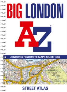
      Big London A-Z Street Atlas

      16 in stock

      Firm sale: non returnable item
      SKU 9780008663506 Categories ,
      Select Guide Rating
      Navigate your way around London with this detailed, easy-to-use and up-to-date A-Z Street Atlas.
      Navigate your way around London with this detailed, easy-to-use and up-to-date A-Z Street Atlas.Large scale A-Z street mapping of London. This A4 street atlas offers the perfect...

      £14.99

      Buy new:

      Delivery: UK delivery Only. Usually dispatched in 1-2 working days.

      Shipping costs: All shipping costs calculated in the cart or during the checkout process.

      Standard service (normally 2-3 working days): 48hr Tracked service.

      Premium service (next working day): 24hr Tracked service – signature service included.

      Royal mail: 24 & 48hr Tracked: Trackable items weighing up to 20kg are tracked to door and are inclusive of text and email with ‘Leave in Safe Place’ options, but are non-signature services. Examples of service expected: Standard 48hr service – if ordered before 3pm on Thursday then expected delivery would be on Saturday. If Premium 24hr service used, then expected delivery would be Friday.

      Signature Service: This service is only available for tracked items.

      Leave in Safe Place: This option is available at no additional charge for tracked services.
      Description

      Product ID:9780008663506
      Product Form:Spiral bound
      Country of Manufacture:GB
      Title:Big London A-Z Street Atlas
      Authors:Author: A-Z Maps
      Page Count:320
      Subjects:World / regional atlases or maps, World atlases / world maps, Travel and holiday guides, Street maps and city plans, Travel & holiday guides, Street maps & city plans, London, Greater London
      Description:Select Guide Rating
      Navigate your way around London with this detailed, easy-to-use and up-to-date A-Z Street Atlas.
      Navigate your way around London with this detailed, easy-to-use and up-to-date A-Z Street Atlas.Large scale A-Z street mapping of London. This A4 street atlas offers the perfect combination of coverage and clarity, the area covered ranges from Heathrow Airport all the way to Chingford at a scale of 4.25 inches to 1 mile (6.71 cm to 1 km), while a detailed map of Central London is at a larger scale of 8.5 inches to 1 mile (13.42 cm to 1 km).The mapping features transport connections, places of interest, public buildings, postcode districts, one-way streets, Congestion and Low Emission ZonesThis comprehensive street atlas of London also includes:• An overview map of the Congestion Charging Zone, and the Ultra Low and Low Emission Zones• West End Theatre and Cinema maps• The London Rail & Tube Services MapA comprehensive index lists streets, selected flats, walkways and places of interest, place, area and junction names. Additional healthcare (hospitals, walk-in centres and hospices) and transport (National Rail, London Tramlink, Docklands Light Railway, London Underground and Overground stations, and River Bus pier) are indexed as well.
      Imprint Name:HarperCollins
      Publisher Name:HarperCollins Publishers
      Country of Publication:GB
      Publishing Date:2024-05-09

      Additional information

      Weight846 g
      Dimensions288 × 213 × 25 mm