Use coupon code “SUMMER20” for a 20% discount on all items! Valid until 2024-08-31

Site Logo
Search Suggestions

      Royal Mail  express delivery to UK destinations

      Regular sales and promotions

      Stock updates every 20 minutes!

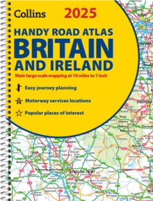
      2025 Collins Handy Road Atlas Britain and Ireland: A5 Spiral

      27 in stock

      Firm sale: non returnable item
      SKU 9780008652890 Categories ,
      Select Guide Rating
      Explore Britain with easy-to-read mapping from Collins.
      Explore Britain with easy-to-read mapping from Collins.This easy-to-use, handy A5 road atlas with spiral binding features extremely clear route planning maps of Britain and Ireland, and fits neatly into your glove box ...

      £5.99

      Buy new:

      Delivery: UK delivery Only. Usually dispatched in 1-2 working days.

      Shipping costs: All shipping costs calculated in the cart or during the checkout process.

      Standard service (normally 2-3 working days): 48hr Tracked service.

      Premium service (next working day): 24hr Tracked service – signature service included.

      Royal mail: 24 & 48hr Tracked: Trackable items weighing up to 20kg are tracked to door and are inclusive of text and email with ‘Leave in Safe Place’ options, but are non-signature services. Examples of service expected: Standard 48hr service – if ordered before 3pm on Thursday then expected delivery would be on Saturday. If Premium 24hr service used, then expected delivery would be Friday.

      Signature Service: This service is only available for tracked items.

      Leave in Safe Place: This option is available at no additional charge for tracked services.
      Description

      Product ID:9780008652890
      Product Form:Spiral bound
      Country of Manufacture:GB
      Series:Collins Road Atlas
      Title:2025 Collins Handy Road Atlas Britain and Ireland
      Subtitle:A5 Spiral
      Authors:Author: Collins Maps
      Page Count:80
      Subjects:Road atlases and maps, Road atlases & maps, United Kingdom, Great Britain, Ireland
      Description:Select Guide Rating
      Explore Britain with easy-to-read mapping from Collins.
      Explore Britain with easy-to-read mapping from Collins.This easy-to-use, handy A5 road atlas with spiral binding features extremely clear route planning maps of Britain and Ireland, and fits neatly into your glove box or bag.The maps of Britain are at 10 miles to 1 inch (1:625,000) and the whole of Ireland is covered at 15.8 miles to 1 inch (1:1,000,000). There are also a selection of more detailed urban area maps at 4.5 miles to 1 inch (1:285,000) to aid route planning in these busy areas.Main features:Road maps that focus on the main roads, motorways and settlementsMore detailed maps of London, Manchester, Merseyside and West MidlandsUpdated Park & Ride locations, new rail stations and extensions to tram lines in Blackpool and EdinburghHandy distance calculator chart highlighting distances between the major townsOver 30 categories of places of interest including castles, theme parks, sports venues and surfing beachesClean Air and Low Emission Zones explained and indicated on mapping
      Imprint Name:Collins
      Publisher Name:HarperCollins Publishers
      Country of Publication:GB
      Publishing Date:2024-03-28

      Additional information

      Weight134 g
      Dimensions210 × 160 × 4 mm