Use coupon code “WINTER20” for a 20% discount on all items! Valid until 30-11-2024

Site Logo
Search Suggestions

      Royal Mail  express delivery to UK destinations

      Regular sales and promotions

      Stock updates every 20 minutes!

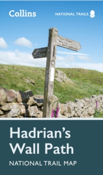
      Hadrian’s Wall Path National Trail Map

      3 in stock

      Firm sale: non returnable item
      SKU 9780008602987 Categories ,
      Select Guide Rating
      Perfect guide and map for planning your adventure along Hadrian’s Wall.
      Perfect guide and map for planning your adventure along Hadrian’s Wall.Highlights of this Planning Map include:More than 20 highlighted places of interest with detailed descriptions and attract...

      £6.99

      Buy new:

      Delivery: UK delivery Only. Usually dispatched in 1-2 working days.

      Shipping costs: All shipping costs calculated in the cart or during the checkout process.

      Standard service (normally 2-3 working days): 48hr Tracked service.

      Premium service (next working day): 24hr Tracked service – signature service included.

      Royal mail: 24 & 48hr Tracked: Trackable items weighing up to 20kg are tracked to door and are inclusive of text and email with ‘Leave in Safe Place’ options, but are non-signature services. Examples of service expected: Standard 48hr service – if ordered before 3pm on Thursday then expected delivery would be on Saturday. If Premium 24hr service used, then expected delivery would be Friday.

      Signature Service: This service is only available for tracked items.

      Leave in Safe Place: This option is available at no additional charge for tracked services.
      Description

      Product ID:9780008602987
      Product Form:Sheet map, folded
      Country of Manufacture:GB
      Title:Hadrian’s Wall Path National Trail Map
      Authors:Author: Collins Maps
      Subjects:European history, British & Irish history, Historical geography, Geographical maps: specialist / thematic maps, Local history, Walking, hiking, trekking, Travel and holiday guides, Travel maps, Historical geography, Geographical maps (specialist), Local history, Walking, hiking, trekking, Travel & holiday guides, Travel maps, North & North East England
      Description:Select Guide Rating
      Perfect guide and map for planning your adventure along Hadrian’s Wall.
      Perfect guide and map for planning your adventure along Hadrian’s Wall.Highlights of this Planning Map include:More than 20 highlighted places of interest with detailed descriptions and attractive photographs, including: the Vindolanda archaeological site, Chester’s Roman fort, and Steel Rigg viewpoint.A comprehensive index to more than 400 cities, towns and villagesA clear, visible route plotted across the mapAdvice on safety and security when travelling along the route, as well as the countryside code and the code of conductPart of the National Trail network, this long-distance footpath covers 84 miles (135 km) along the line of Hadrian''s Wall from coast-to-coast. Starting in Wallsend in Newcastle and ending in Bowness-on-Solway, this path weaves through beautiful countryside, encountering historic remains of Roman forts and milecastles, and splendid bridges. A suggested walking itinerary makes it easy for users to plan their journey along this popular route.
      Imprint Name:Collins
      Publisher Name:HarperCollins Publishers
      Country of Publication:GB
      Publishing Date:2023-02-16

      Additional information

      Weight64 g
      Dimensions115 × 198 × 10 mm