Description
| Product ID: | 9780008532192 |
| Product Form: | Paperback / softback |
| Country of Manufacture: | GB |
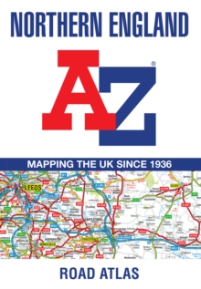
| Title: | Northern England A-Z Road Atlas |
| Authors: | Author: A-Z Maps |
| Page Count: | 80 |
| Subjects: | Road atlases and maps, Road atlases & maps, Travel maps, Travel maps, North West England, North & North East England |
| Description: | Select Guide Rating Find your way around Northern England with this fully revised and updated road atlas. A full colour regional road atlas featuring 52 pages of road mapping. Find your way around Northern England with this fully revised and updated road atlas.A full colour regional road atlas featuring 52 pages of road mapping.Covers an area extending to:Berwick-upon-TweedNewcastle upon TyneMiddlesbroughKingston upon HullGrimsbyBostonNottinghamStoke-on-TrentWrexhamChesterLiverpoolBlackpoolBarrow-in-FurnessDumfriesThe road mapping is shown at a clear 3.5 miles to 1 inch scale (2.2 km to 1 cm) and includes the following features:Motorways open with full junction detail, motorways under construction and proposed, service areas, primary routes and destinations, A & B roads, selected minor roads, gradients 1:5 and steeper, tolls, mileages, county boundaries, spot heights and hill shadingSelected safety camera locations with their maximum speed limitsSelected fuel stationsNational Park boundariesSelected places of interest, tourist information centres and golf coursesAlso, within this Northern England Road Atlas are 24 city, town, airport or port plans for:BlackpoolBradfordCarlisleChesterDerbyDumfriesDurhamHarrogateKingston upon HullLeedsLincolnLiverpoolManchesterMiddlesbroughNewcastle upon TyneNottinghamPrestonSheffieldStoke-on-TrentSunderlandYorkManchester AirportKingston upon Hull PortNewcastle upon Tyne PortThe index section lists cities, towns, villages, hamlets and locations covered by this atlas. |
| Imprint Name: | HarperCollins |
| Publisher Name: | HarperCollins Publishers |
| Country of Publication: | GB |
| Publishing Date: | 2022-05-12 |


