Use coupon code “WINTER20” for a 20% discount on all items! Valid until 30-11-2024

Site Logo
Search Suggestions

      Royal Mail  express delivery to UK destinations

      Regular sales and promotions

      Stock updates every 20 minutes!

      Skye Pocket Map: The Perfect Way to Explore Skye

      11 in stock

      Firm sale: non returnable item
      SKU 9780008492595 Categories ,
      Select Guide Rating
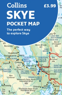
      Handy little full colour Collins map of Skye with a high level of detail. Clear mapping of the Isle of Skye showing the road network, ferries and places of interest. Map at a scale of 1:175 000 (3 miles to 1 inch).
      Handy little full colour Collins map of Skye with a high le...

      £3.99

      Buy new:

      Delivery: UK delivery Only. Usually dispatched in 1-2 working days.

      Shipping costs: All shipping costs calculated in the cart or during the checkout process.

      Standard service (normally 2-3 working days): 48hr Tracked service.

      Premium service (next working day): 24hr Tracked service – signature service included.

      Royal mail: 24 & 48hr Tracked: Trackable items weighing up to 20kg are tracked to door and are inclusive of text and email with ‘Leave in Safe Place’ options, but are non-signature services. Examples of service expected: Standard 48hr service – if ordered before 3pm on Thursday then expected delivery would be on Saturday. If Premium 24hr service used, then expected delivery would be Friday.

      Signature Service: This service is only available for tracked items.

      Leave in Safe Place: This option is available at no additional charge for tracked services.
      Description

      Product ID:9780008492595
      Product Form:Sheet map, folded
      Country of Manufacture:GB
      Title:Skye Pocket Map
      Subtitle:The Perfect Way to Explore Skye
      Authors:Author: Collins Maps
      Page Count:1
      Subjects:World / regional atlases or maps, World atlases / world maps, Geographical maps: specialist / thematic maps, Cartography, map-making and projections, Travel and holiday guides, Travel guides: caravan and camp-site guides, Road atlases and maps, Street maps and city plans, Geographical maps (specialist), Cartography, map-making & projections, Travel & holiday guides, Caravan & camp-site guides, Road atlases & maps, Street maps & city plans, Isle of Skye
      Description:Select Guide Rating
      Handy little full colour Collins map of Skye with a high level of detail. Clear mapping of the Isle of Skye showing the road network, ferries and places of interest. Map at a scale of 1:175 000 (3 miles to 1 inch).
      Handy little full colour Collins map of Skye with a high level of detail. Clear mapping of the Isle of Skye showing the road network, ferries and places of interest. Map at a scale of 1:175 000 (3 miles to 1 inch).Clear, detailed, full colour Collins road mapping is presented in a handy format ideal for the pocket or handbag. It is excellent value and covers the whole of the Isle of Skye.This map includes:• Scotland route map• Caravan and camping sites• Tourist locations• Ferry links• Listing of major places to visit, with additional details for Dunvegan Castle, Old Man of Storr and Loch Coruisk• Detailed place names index
      Imprint Name:Collins
      Publisher Name:HarperCollins Publishers
      Country of Publication:GB
      Publishing Date:2022-02-03

      Additional information

      Weight42 g
      Dimensions91 × 139 × 12 mm