Use coupon code “SUMMER20” for a 20% discount on all items! Valid until 2024-08-31

Site Logo
Search Suggestions

      Royal Mail  express delivery to UK destinations

      Regular sales and promotions

      Stock updates every 20 minutes!

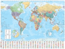
      Collins World Wall Laminated Map

      56 in stock

      Firm sale: non returnable item
      SKU 9780008492540 Categories ,
      Select Guide Rating
      Explore the world with a Collins wall map
      Explore the world with a Collins wall mapFully updated world map to include the latest political changes. Contains politically coloured mapping showing each country and their capital city, major roads, railways and cities and towns ...

      £12.99

      Buy new:

      Delivery: UK delivery Only. Usually dispatched in 1-2 working days.

      Shipping costs: All shipping costs calculated in the cart or during the checkout process.

      Standard service (normally 2-3 working days): 48hr Tracked service.

      Premium service (next working day): 24hr Tracked service – signature service included.

      Royal mail: 24 & 48hr Tracked: Trackable items weighing up to 20kg are tracked to door and are inclusive of text and email with ‘Leave in Safe Place’ options, but are non-signature services. Examples of service expected: Standard 48hr service – if ordered before 3pm on Thursday then expected delivery would be on Saturday. If Premium 24hr service used, then expected delivery would be Friday.

      Signature Service: This service is only available for tracked items.

      Leave in Safe Place: This option is available at no additional charge for tracked services.
      Description

      Product ID:9780008492540
      Product Form:Sheet map, flat
      Country of Manufacture:GB
      Title:Collins World Wall Laminated Map
      Authors:Author: Collins Maps
      Subjects:World / regional atlases or maps, World atlases / world maps, Teachers’ classroom resources and material, Political geography, Geographical maps: specialist / thematic maps, Cartography, map-making and projections, Travel maps, Educational: Geography, Teachers' classroom resources & material, Political geography, Geographical maps (specialist), Cartography, map-making & projections, Travel maps, Educational: Geography
      Description:Select Guide Rating
      Explore the world with a Collins wall map
      Explore the world with a Collins wall mapFully updated world map to include the latest political changes. Contains politically coloured mapping showing each country and their capital city, major roads, railways and cities and towns clearly. Also included are national flags, key statistics for every country and inset maps of the polar regions.This laminated (on front side only) map is printed on high quality paper and comes rolled in a plastic tube – ideal as a poster for any classroom, bedroom or office wall.Area of coverage:All of the world, centred on the Greenwich Meridian, and including maps of the North and South Pole regions.Scale:1:22 000 000; 1 cm to 220 km; 1 inch to 347 milesSize:1015 x 1380 mm (40 x 54 inches)Other versions available:Paper flat map in tube (ISBN 978000821158-5).
      Imprint Name:Collins
      Publisher Name:HarperCollins Publishers
      Country of Publication:GB
      Publishing Date:2022-03-31

      Additional information

      Weight414 g
      Dimensions1065 × 45 × 45 mm