Use coupon code “SUMMER20” for a 20% discount on all items! Valid until 2024-08-31

Site Logo
Search Suggestions

      Royal Mail  express delivery to UK destinations

      Regular sales and promotions

      Stock updates every 20 minutes!

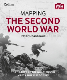
      Mapping the Second World War: The History of the War Through Maps from 1939 to 1945

      Out of stock

      Firm sale: non returnable item
      SKU 9780008136581 Categories ,
      Select Guide Rating
      Follow the conflict of the Second World War from 1939 to 1945 in this unique volume, published in association with Imperial War Museums, London, featuring historical maps and photographs from their archives, and fascinating commentary from an expert historian.
      Follow the co...

      £30.00

      Buy new:

      Delivery: UK delivery Only. Usually dispatched in 1-2 working days.

      Shipping costs: All shipping costs calculated in the cart or during the checkout process.

      Standard service (normally 2-3 working days): 48hr Tracked service.

      Premium service (next working day): 24hr Tracked service – signature service included.

      Royal mail: 24 & 48hr Tracked: Trackable items weighing up to 20kg are tracked to door and are inclusive of text and email with ‘Leave in Safe Place’ options, but are non-signature services. Examples of service expected: Standard 48hr service – if ordered before 3pm on Thursday then expected delivery would be on Saturday. If Premium 24hr service used, then expected delivery would be Friday.

      Signature Service: This service is only available for tracked items.

      Leave in Safe Place: This option is available at no additional charge for tracked services.
      Description

      Product ID:9780008136581
      Product Form:Hardback
      Country of Manufacture:CN
      Title:Mapping the Second World War
      Subtitle:The History of the War Through Maps from 1939 to 1945
      Authors:Author: Collins Books, The Imperial War Museum, Peter Chasseaud
      Page Count:304
      Subjects:European history, European history, History, Historical maps and atlases, Second World War, 20th century history: c 1900 to c 2000, Historical maps & atlases, Second World War, Europe, c 1939 to c 1945 (including WW2)
      Description:Select Guide Rating
      Follow the conflict of the Second World War from 1939 to 1945 in this unique volume, published in association with Imperial War Museums, London, featuring historical maps and photographs from their archives, and fascinating commentary from an expert historian.
      Follow the conflict of the Second World War from 1939 to 1945 in this unique volume, published in association with Imperial War Museums, London, featuring historical maps and photographs from their archives, and fascinating commentary from an expert historian.Over 150 maps tell the story of how this global war was fought.Types of maps featured:• Strategic maps showing theatres of war, frontiers and occupied territories• Maps covering key battles and offensives on major fronts• Planning and operations maps showing defences in detail• Propaganda and educational maps for the armed forces and general public• Maps showing dispositions of Allied and enemy forces• Bomber and V-weapon target mapsDescriptions of key historical events accompany the maps, giving an illustrated history of the war from an expert historian.Key topics covered include• 1939: Invasion of Poland• 1940: German invasion of Low Countries & France• 1940: Battle of Britain & German invasion threat• Dec 1941: Pearl Harbor• 1942: Turning points: Midway, Alamein, Stalingrad• 1941-45: Barbarossa and the Eastern Front• The War at Sea• The advances to Jerusalem, Damascus and Baghdad• The War in the Air• 1944: Neptune & Overlord; D-Day & liberation of France
      Imprint Name:Collins
      Publisher Name:HarperCollins Publishers
      Country of Publication:GB
      Publishing Date:2015-10-08

      Additional information

      Weight1516 g
      Dimensions274 × 230 × 26 mm