Use coupon code “WINTER20” for a 20% discount on all items! Valid until 30-11-2024

Site Logo
Search Suggestions

      Royal Mail  express delivery to UK destinations

      Regular sales and promotions

      Stock updates every 20 minutes!

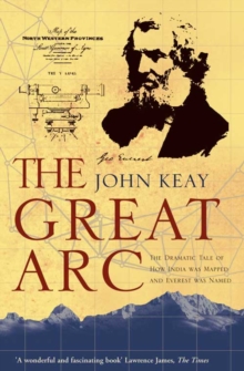
      The Great Arc: The Dramatic Tale of How India Was Mapped and Everest Was Named

      1 in stock

      Firm sale: non returnable item
      SKU 9780006531234 Categories ,
      Select Guide Rating
      A vivid description of one of the most ambitious scientific projects undertaken in the 19th century, and the men who undertook the measurement of the Himalayas and the mapping of the Indian subcontinent: William Lambton and George Everest.
      A vivid description of one of the ...

      £10.99

      Buy new:

      Delivery: UK delivery Only. Usually dispatched in 1-2 working days.

      Shipping costs: All shipping costs calculated in the cart or during the checkout process.

      Standard service (normally 2-3 working days): 48hr Tracked service.

      Premium service (next working day): 24hr Tracked service – signature service included.

      Royal mail: 24 & 48hr Tracked: Trackable items weighing up to 20kg are tracked to door and are inclusive of text and email with ‘Leave in Safe Place’ options, but are non-signature services. Examples of service expected: Standard 48hr service – if ordered before 3pm on Thursday then expected delivery would be on Saturday. If Premium 24hr service used, then expected delivery would be Friday.

      Signature Service: This service is only available for tracked items.

      Leave in Safe Place: This option is available at no additional charge for tracked services.
      Description

      Product ID:9780006531234
      Product Form:Paperback / softback
      Country of Manufacture:GB
      Title:The Great Arc
      Subtitle:The Dramatic Tale of How India Was Mapped and Everest Was Named
      Authors:Author: John Keay
      Page Count:224
      Subjects:Asian history, Asian history, History, Popular science, Surveying, quantity surveying, Travel maps, Modern history to 20th century: c 1700 to c 1900, Popular science, Surveying, Travel maps, Himalayas, c 1800 to c 1900
      Description:Select Guide Rating
      A vivid description of one of the most ambitious scientific projects undertaken in the 19th century, and the men who undertook the measurement of the Himalayas and the mapping of the Indian subcontinent: William Lambton and George Everest.
      A vivid description of one of the most ambitious scientific projects undertaken in the 19th century, and the men who undertook the measurement of the Himalayas and the mapping of the Indian subcontinent: William Lambton and George Everest.The graphic story of the measurement of a meridian, or longitudinal, arc extending from the tip of the Indian subcontinent to the mountains of the Himalayas.Much the longest such measurement hitherto made, it posed horrendous technical difficulties, made impossible physical demands on the survey parties (jungle, tigers, mountains etc.), and took over 50 years. But the scientific results were commensurate, including the discovery of the world’s highest peaks and a new calculation of the curvature of the earth’s surface.The Indian Mutiny of 1857 triggered a massive construction of roads, railways, telegraph lines and canals throughout India: all depended heavily on the accuracy of the maps which the Great Arc had made possible.
      Imprint Name:HarperCollins
      Publisher Name:HarperCollins Publishers
      Country of Publication:GB
      Publishing Date:2001-08-06

      Additional information

      Weight190 g
      Dimensions200 × 129 × 12 mm