Use coupon code “WINTER20” for a 20% discount on all items! Valid until 30-11-2024

Site Logo
Search Suggestions

      Royal Mail  express delivery to UK destinations

      Regular sales and promotions

      Stock updates every 20 minutes!

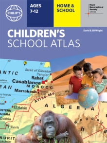
      Philip’s RGS Children’s School Atlas: 16th Edition

      16 in stock

      Firm sale: non returnable item
      SKU 9781849075817 Categories ,
      Select Guide Rating
      In Philip's RGS Children's Atlas, clear and accurate maps are combined with fascinating facts about the countries of the world to provide essential geographical information for young readers aged 7-12. Guidance for parents and teachers is given on how to use the maps, encourag...

      £12.99

      Buy new:

      Delivery: UK delivery Only. Usually dispatched in 1-2 working days.

      Shipping costs: All shipping costs calculated in the cart or during the checkout process.

      Standard service (normally 2-3 working days): 48hr Tracked service.

      Premium service (next working day): 24hr Tracked service – signature service included.

      Royal mail: 24 & 48hr Tracked: Trackable items weighing up to 20kg are tracked to door and are inclusive of text and email with ‘Leave in Safe Place’ options, but are non-signature services. Examples of service expected: Standard 48hr service – if ordered before 3pm on Thursday then expected delivery would be on Saturday. If Premium 24hr service used, then expected delivery would be Friday.

      Signature Service: This service is only available for tracked items.

      Leave in Safe Place: This option is available at no additional charge for tracked services.

      Description

      Product ID:9781849075817
      Product Form:Hardback
      Country of Manufacture:CN
      Series:Philip's World Atlas
      Title:Philip's RGS Children's School Atlas
      Subtitle:16th Edition
      Authors:Author: David Wright, Philip's Maps, Jill Wright
      Page Count:96
      Subjects:World / regional atlases or maps, World atlases / world maps, Travel maps, Children’s / Teenage general interest: Places and peoples, Educational: Geography, Children’s / Teenage reference: Atlases and maps, Travel maps, People & places (Children's / Teenage), Educational: Geography, Atlases & maps (Children’s/Teenage), For National Curriculum Key Stage 1, For National Curriculum Key Stage 2, For National Curriculum Key Stage 3
      Description:Select Guide Rating
      In Philip's RGS Children's Atlas, clear and accurate maps are combined with fascinating facts about the countries of the world to provide essential geographical information for young readers aged 7-12. Guidance for parents and teachers is given on how to use the maps, encouraging the early development of geographical skills.

      "This is such a great book for primary school age children and a little beyond for finding out about the world, its countries and people" Amazon customer review

      - Philip''s atlas, designed specially to use at home and at school with guidance for parents and teachers
      - Clear maps and fascinating facts bring geography to life for readers aged 7-12
      - Published by Philip''s the UK''s leading school atlas publisher, in association with the Royal Geographical Society
      - Quizzes, activity ideas and puzzles to make learning fun
      - Past winner of the Geographical Association''s award for making a significant contribution to geography

      The atlas is organized spread by spread in the classic sequence: first Europe, then its land neighbour Asia, followed by Africa, Australia and Oceania, North America and South America.

      Illustrated with captivating full-colour photographs and packed with fact boxes, curiosities, flags, stamps and quiz questions, Philip''s RGS Children''s Atlas is both fun to use and easy to understand.

      Now in its 16th edition, Philip''s RGS Children''s Atlas is a past winner of the Geographical Association''s award for making a significant contribution to geography. The atlas was judged "an excellent ''all round'' children''s atlas with simple yet well-designed maps, well-illustrated with colour photographs. It links places to issues, events and real people, giving a clear sense of place."


      Imprint Name:Philip's
      Publisher Name:Octopus Publishing Group
      Country of Publication:GB
      Publishing Date:2021-10-07

      Additional information

      Weight706 g
      Dimensions247 × 295 × 13 mm