Use coupon code “WINTER20” for a 20% discount on all items! Valid until 30-11-2024

Site Logo
Search Suggestions

      Royal Mail  express delivery to UK destinations

      Regular sales and promotions

      Stock updates every 20 minutes!

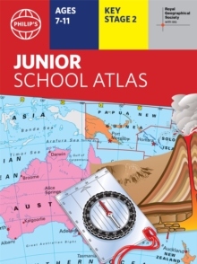
      Philip’s RGS Junior School Atlas

      6 in stock

      Firm sale: non returnable item
      SKU 9781849075800 Categories ,
      Select Guide Rating
      The market-leading atlas for pupils at primary schools, Philip's RGS Junior School Atlas has been fully revised and updated for its 11th edition.

      The 11th edition of the market-leading atlas for primary school pupils, Philip''s RGS Junior School Atlas has been fully r...

      £8.99

      Buy new:

      Delivery: UK delivery Only. Usually dispatched in 1-2 working days.

      Shipping costs: All shipping costs calculated in the cart or during the checkout process.

      Standard service (normally 2-3 working days): 48hr Tracked service.

      Premium service (next working day): 24hr Tracked service – signature service included.

      Royal mail: 24 & 48hr Tracked: Trackable items weighing up to 20kg are tracked to door and are inclusive of text and email with ‘Leave in Safe Place’ options, but are non-signature services. Examples of service expected: Standard 48hr service – if ordered before 3pm on Thursday then expected delivery would be on Saturday. If Premium 24hr service used, then expected delivery would be Friday.

      Signature Service: This service is only available for tracked items.

      Leave in Safe Place: This option is available at no additional charge for tracked services.

      Description

      Product ID:9781849075800
      Product Form:Paperback / softback
      Country of Manufacture:CN
      Series:Philip's World Atlas
      Title:Philip's RGS Junior School Atlas
      Authors:Author: Philip's Maps
      Page Count:287
      Subjects:World / regional atlases or maps, World atlases / world maps, Educational: Geography, Children’s / Teenage reference: Atlases and maps, Educational: Geography, Atlases & maps (Children’s/Teenage), For National Curriculum Key Stage 2
      Description:Select Guide Rating
      The market-leading atlas for pupils at primary schools, Philip's RGS Junior School Atlas has been fully revised and updated for its 11th edition.

      The 11th edition of the market-leading atlas for primary school pupils, Philip''s RGS Junior School Atlas has been fully revised and updated with all the latest facts and curriculum requirements.

      - The essential atlas for primary schools with clear and easy-to-follow maps and diagrams - updated for 2021/22
      - Published in association with the Royal Geographical Society
      - Recommended for Key Stage 2 of the National Curriculum - and all 7-11 year olds
      - An excellent introduction to mapping concepts such as scale, direction, symbols, longitude and latitude
      - 22-page Britain and Ireland section with clear thematic charts, diagrams and large-scale regional maps
      - 22-page section on The World, with political maps - and thematic treatment of key themes, from volcanoes and earthquakes to transport and tourism
      - Continents section with physical and political maps
      - Easy-to-follow map references and 1,000-place index

      The market-leading atlas for pupils at primary schools, Philip''s RGS Junior School Atlas is a stimulating and authoritative first introduction to the world of maps, and is recommended for Key Stage 2 of the National Curriculum.

      The introductory section describes the meaning of scale, how to measure distances using the maps, and explains the symbols on the maps.

      The following section is devoted to the United Kingdom and Ireland. Thematic maps cover topics such as mountains and rivers, climate and weather, population and cities, farming and fishing, industry and energy, transport, tourism and conservation. Regional maps of England and Wales, Scotland and Ireland complete this section.

      The rest of the atlas is made up of world thematic maps and world continental maps. Included are topics such as the world''s climate, vegetation, agriculture, energy sources, and environmental concerns, such as global warming. A simple letter-figure index completes the atlas - a useful introduction to help the young reader find his/her way around the maps. Available in both hardback and paperback editions.


      Imprint Name:Philip's
      Publisher Name:Octopus Publishing Group
      Country of Publication:GB
      Publishing Date:2021-10-27

      Additional information

      Weight284 g
      Dimensions224 × 299 × 9 mm