Use coupon code “WINTER20” for a 20% discount on all items! Valid until 30-11-2024

Site Logo
Search Suggestions

      Royal Mail  express delivery to UK destinations

      Regular sales and promotions

      Stock updates every 20 minutes!

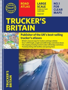
      Philip’s Trucker’s Road Atlas of Britain: (Spiral A3)

      1 in stock

      Firm sale: non returnable item
      SKU 9781849075763 Categories ,
      Select Guide Rating
      The latest Philip's Trucker's Road Atlas Britain shows over 4,000 bridges with restrictions - either height, weight or width - and is indispensable for anyone driving a large vehicle. Super-clear maps and packed with the most useful information for drivers of large vehicles.<...

      £16.99

      Buy new:

      Delivery: UK delivery Only. Usually dispatched in 1-2 working days.

      Shipping costs: All shipping costs calculated in the cart or during the checkout process.

      Standard service (normally 2-3 working days): 48hr Tracked service.

      Premium service (next working day): 24hr Tracked service – signature service included.

      Royal mail: 24 & 48hr Tracked: Trackable items weighing up to 20kg are tracked to door and are inclusive of text and email with ‘Leave in Safe Place’ options, but are non-signature services. Examples of service expected: Standard 48hr service – if ordered before 3pm on Thursday then expected delivery would be on Saturday. If Premium 24hr service used, then expected delivery would be Friday.

      Signature Service: This service is only available for tracked items.

      Leave in Safe Place: This option is available at no additional charge for tracked services.

      Description

      Product ID:9781849075763
      Product Form:Spiral bound
      Country of Manufacture:CN
      Series:Philip's Road Atlases
      Title:Philip's Trucker's Road Atlas of Britain
      Subtitle:(Spiral A3)
      Authors:Author: Philip's Maps
      Page Count:168
      Subjects:Road transport and haulage trades, Road transport & haulage trades, Road atlases and maps, Road atlases & maps, United Kingdom, Great Britain
      Description:Select Guide Rating
      The latest Philip's Trucker's Road Atlas Britain shows over 4,000 bridges with restrictions - either height, weight or width - and is indispensable for anyone driving a large vehicle. Super-clear maps and packed with the most useful information for drivers of large vehicles.

      PHILIP''S - THE ATLAS BRAND FOR TRUCKERS, CARAVANNERS AND OTHER SERIOUS ROAD USERS

      "The best of its kind with quick and easy to use information" Fleet Week

      - Essential for Truckers (and very useful for Caravanners too)
      - Over 4,000 bridges with restrictions - either height, weight or width - located on the maps
      - Super-clear maps of the UK at 1:200,000 (Northern Scotland 1:250,000)

      - Special Feature: "Bridge Strikes" (including "Most Hit Bridges", numbering approximately 50, which includes all bridges struck five or more time in a 12-month period
      - Lists Restricted Motorway Junctions with explanations
      - Truck stop listings and location maps, including the facilities and opening times
      - Big format and spiral binding - easy-to-use on the road
      - 12 pages of urban area maps with bridge restrictions
      - Central London maps - with bridge restrictions

      ''Even though I have a satnav I find a map essential for planning in stops on long routes.'' a trucker customer


      Imprint Name:Philip's
      Publisher Name:Octopus Publishing Group
      Country of Publication:GB
      Publishing Date:2021-10-07

      Additional information

      Weight996 g
      Dimensions298 × 397 × 19 mm