Use coupon code “SUMMER20” for a 20% discount on all items! Valid until 2024-08-31

Site Logo
Search Suggestions

      Royal Mail  express delivery to UK destinations

      Regular sales and promotions

      Stock updates every 20 minutes!

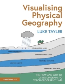
      Visualising Physical Geography: The How and Why of Using Diagrams to Teach Geography 11–16

      1 in stock

      Firm sale: non returnable item
      SKU 9781032301051 Categories ,
      Select Guide Rating
      This practical guide breaks down the complex and broad field of physical geography, demonstrating how diagrams can be used by teachers to effectively explain the key concepts behind many natural processes and landforms. With over 200 diagrams that cover key topics, this is an ...

      £18.99

      Buy new:

      Delivery: UK delivery Only. Usually dispatched in 1-2 working days.

      Shipping costs: All shipping costs calculated in the cart or during the checkout process.

      Standard service (normally 2-3 working days): 48hr Tracked service.

      Premium service (next working day): 24hr Tracked service – signature service included.

      Royal mail: 24 & 48hr Tracked: Trackable items weighing up to 20kg are tracked to door and are inclusive of text and email with ‘Leave in Safe Place’ options, but are non-signature services. Examples of service expected: Standard 48hr service – if ordered before 3pm on Thursday then expected delivery would be on Saturday. If Premium 24hr service used, then expected delivery would be Friday.

      Signature Service: This service is only available for tracked items.

      Leave in Safe Place: This option is available at no additional charge for tracked services.

      Description

      Product ID:9781032301051
      Product Form:Paperback / softback
      Country of Manufacture:GB
      Title:Visualising Physical Geography: The How and Why of Using Diagrams to Teach Geography 11–16
      Authors:Author: Luke Tayler
      Page Count:286
      Subjects:Secondary schools, Secondary schools, Teacher training, Teaching skills and techniques, Teacher training, Teaching skills & techniques
      Description:Select Guide Rating
      This practical guide breaks down the complex and broad field of physical geography, demonstrating how diagrams can be used by teachers to effectively explain the key concepts behind many natural processes and landforms. With over 200 diagrams that cover key topics, this is an essential guide for any Key Stage 3 or 4 Geography teacher.

      This practical guide breaks down the complex and broad field of physical geography, demonstrating how diagrams can be used by teachers to effectively explain the key concepts behind many natural processes and landforms. Featuring over 200 diagrams that cover the key topics taught in Key Stage 3 and 4 Geography, the book shows teachers how they can convey age-appropriate concepts without overwhelming or oversimplifying.

      Supported by summaries of background knowledge, common misconceptions, questions to check understanding, and extension activities, the concepts and topics explored include:

      • Rocks and weathering
      • Plate tectonics
      • Rivers
      • Coasts
      • Weather and climate
      • Ecosystems
      • Glaciation

      Backed by research and evidence to support the use of diagrams in the classroom, this is an essential read for any geography teacher or subject lead who wants to support their students in learning key concepts in physical geography.


      Imprint Name:Routledge
      Publisher Name:Taylor & Francis Ltd
      Country of Publication:GB
      Publishing Date:2023-09-29

      Additional information

      Weight796 g
      Dimensions189 × 246 × 19 mm