Use coupon code “SUMMER20” for a 20% discount on all items! Valid until 2024-08-31

Site Logo
Search Suggestions

      Royal Mail  express delivery to UK destinations

      Regular sales and promotions

      Stock updates every 20 minutes!

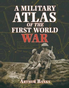
      A Military Atlas of the First World War

      3 in stock

      Firm sale: non returnable item
      SKU 9780850527919 Categories ,
      Select Guide Rating
      This is a unique study of the conflict of 1914-18 on land, sea and in the air, through maps, diagrams and illustrations. Within the scope of some 250 maps, Arthur Banks has presented both broad general surveys of political and military strategy, and the most closely researched...

      £19.99

      Buy new:

      Delivery: UK delivery Only. Usually dispatched in 1-2 working days.

      Shipping costs: All shipping costs calculated in the cart or during the checkout process.

      Standard service (normally 2-3 working days): 48hr Tracked service.

      Premium service (next working day): 24hr Tracked service – signature service included.

      Royal mail: 24 & 48hr Tracked: Trackable items weighing up to 20kg are tracked to door and are inclusive of text and email with ‘Leave in Safe Place’ options, but are non-signature services. Examples of service expected: Standard 48hr service – if ordered before 3pm on Thursday then expected delivery would be on Saturday. If Premium 24hr service used, then expected delivery would be Friday.

      Signature Service: This service is only available for tracked items.

      Leave in Safe Place: This option is available at no additional charge for tracked services.

      Description

      Product ID:9780850527919
      Product Form:Paperback / softback
      Country of Manufacture:GB
      Title:A Military Atlas of the First World War
      Authors:Author: Arthur Banks
      Page Count:340
      Subjects:European history, European history, First World War, First World War, Europe, c 1914 to c 1918 (including WW1)
      Description:Select Guide Rating
      This is a unique study of the conflict of 1914-18 on land, sea and in the air, through maps, diagrams and illustrations. Within the scope of some 250 maps, Arthur Banks has presented both broad general surveys of political and military strategy, and the most closely researched details of major individual campaigns and engagements. These are supplemented by comprehensive analysis of military strengths and command structures and illustrations.
      Imprint Name:Pen & Sword Books Ltd
      Publisher Name:Pen & Sword Books Ltd
      Country of Publication:GB
      Publishing Date:2000-09-13

      Additional information

      Weight980 g
      Dimensions247 × 264 × 21 mm