Use coupon code “WINTER20” for a 20% discount on all items! Valid until 30-11-2024

Site Logo
Search Suggestions

      Royal Mail  express delivery to UK destinations

      Regular sales and promotions

      Stock updates every 20 minutes!

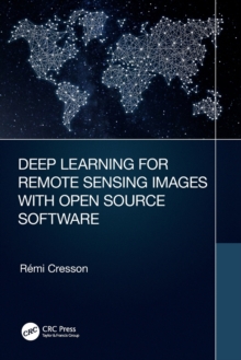
      Deep Learning for Remote Sensing Images with Open Source Software

      Out of stock

      Firm sale: non returnable item
      SKU 9780367518981 Categories ,
      This is the first practical book to introduce deep learning techniques using free open source tools for processing real world remote sensing images. The approaches are generic and adapted to suit applications for various remote sensing images processing in landcover mapping, forestry, urban, in disa...

      £32.99

      Buy new:

      Delivery: UK delivery Only. Usually dispatched in 1-2 working days.

      Shipping costs: All shipping costs calculated in the cart or during the checkout process.

      Standard service (normally 2-3 working days): 48hr Tracked service.

      Premium service (next working day): 24hr Tracked service – signature service included.

      Royal mail: 24 & 48hr Tracked: Trackable items weighing up to 20kg are tracked to door and are inclusive of text and email with ‘Leave in Safe Place’ options, but are non-signature services. Examples of service expected: Standard 48hr service – if ordered before 3pm on Thursday then expected delivery would be on Saturday. If Premium 24hr service used, then expected delivery would be Friday.

      Signature Service: This service is only available for tracked items.

      Leave in Safe Place: This option is available at no additional charge for tracked services.

      Description

      Product ID:9780367518981
      Product Form:Paperback / softback
      Country of Manufacture:US
      Series:Signal and Image Processing of Earth Observations
      Title:Deep Learning for Remote Sensing Images with Open Source Software
      Authors:Author: Remi Cresson
      Page Count:152
      Subjects:Risk assessment, Risk assessment, Earth sciences, Geographical information systems, geodata and remote sensing, Urban and municipal planning and policy, Environmental science, engineering and technology, Agricultural science, Forestry and silviculture, Image processing, Earth sciences, Geographical information systems (GIS) & remote sensing, Urban & municipal planning, Environmental science, engineering & technology, Agricultural science, Forestry & silviculture: practice & techniques, Image processing
      Description:This is the first practical book to introduce deep learning techniques using free open source tools for processing real world remote sensing images. The approaches are generic and adapted to suit applications for various remote sensing images processing in landcover mapping, forestry, urban, in disaster mapping, image restoration, etc.

      In today’s world, deep learning source codes and a plethora of open access geospatial images are readily available and easily accessible. However, most people are missing the educational tools to make use of this resource. Deep Learning for Remote Sensing Images with Open Source Software is the first practical book to introduce deep learning techniques using free open source tools for processing real world remote sensing images. The approaches detailed in this book are generic and can be adapted to suit many different applications for remote sensing image processing, including landcover mapping, forestry, urban studies, disaster mapping, image restoration, etc. Written with practitioners and students in mind, this book helps link together the theory and practical use of existing tools and data to apply deep learning techniques on remote sensing images and data.

      Specific Features of this Book:

      • The first book that explains how to apply deep learning techniques to public, free available data (Spot-7 and Sentinel-2 images, OpenStreetMap vector data), using open source software (QGIS, Orfeo ToolBox, TensorFlow)
      • Presents approaches suited for real world images and data targeting large scale processing and GIS applications
      • Introduces state of the art deep learning architecture families that can be applied to remote sensing world, mainly for landcover mapping, but also for generic approaches (e.g. image restoration)
      • Suited for deep learning beginners and readers with some GIS knowledge. No coding knowledge is required to learn practical skills.
      • Includes deep learning techniques through many step by step remote sensing data processing exercises.

      Imprint Name:CRC Press
      Publisher Name:Taylor & Francis Ltd
      Country of Publication:GB
      Publishing Date:2022-01-16

      Additional information

      Weight290 g
      Dimensions155 × 233 × 13 mm