Description
| Product ID: | 9781119159124 |
| Product Form: | Hardback |
| Country of Manufacture: | US |
| Series: | Geophysical Monograph Series |
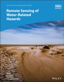
| Title: | Remote Sensing of Water-Related Hazards |
| Authors: | Author: Amir AghaKouchak, Yang Hong, Ke Zhang |
| Page Count: | 272 |
| Subjects: | Earth sciences, Earth sciences, Geographical information systems, geodata and remote sensing, Natural disasters, Electronics and communications engineering, Civil engineering, surveying and building, Geographical information systems (GIS) & remote sensing, Natural disasters, Electronics & communications engineering, Civil engineering, surveying & building |
| Description: | Applications of remote sensing technology for monitoring and predicting water-related hazards Water-related hazards such as floods and droughts have serious impacts on society. Their incidence has increased in recent decades, a trend set to continue with ongoing climate change. Adaptation and mitigation measures require accurate detection, monitoring, and forecasting, much of which comes from remote sensing technologies. Remote Sensing of Water-Related Hazards takes an interdisciplinary approach, presenting recent advances in the available data, sensors, models, and indicators developed for monitoring and prediction. Volume highlights include: Progress in remote sensing of precipitation, storms, and tornadosDifferent techniques for flood mapping, forecasting, and early warningIntegrated approach for predicting flood and landslide cascading hazardsSatellite monitoring of water cycle variation, water scarcity, and drought conditionsMulti-indicator and multi-sensor approaches for quantifying drought impactsThe American Geophysical Union promotes discovery in Earth and space science for the benefit of humanity. Its publications disseminate scientific knowledge and provide resources for researchers, students, and professionals. |
| Imprint Name: | American Geophysical Union |
| Publisher Name: | John Wiley & Sons Inc |
| Country of Publication: | GB |
| Publishing Date: | 2022-04-01 |


